
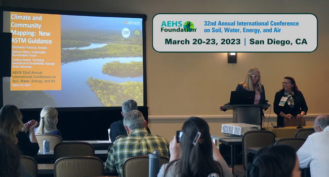
ASTM’s Climate and Community Mapping Team Working on New Standard Guide

Recent U.S. federal and state laws focus on screening to identify disadvantaged communities that bear a disproportionate burden of impacts from environmental pollution and climate change impacts. At the Association for Environmental Health and Sciences Foundation (AEHS) West Coast conference in March, Stephanie Fiorenza (Past SURF At-Large Trustee) presented information about the Climate and Community Mapping Team’s work on a new ASTM standard guide. The guide will:
- Summarize and identify key publicly available mapping tools that can be used to identify vulnerable communities and climate risk.
- Provide guidance on quality of data used by the mapping tools (e.g., identify data sources and limitations and evaluate data completeness and relevance).
- Illustrate the use of different mapping tools in case studies.
Team members are from the EPA, Federal Emergency Management Agency (FEMA), consulting, and ESRI. Through her work on the team, Stephanie has learned about how important it is to click on the tool’s “About the Data” link (see Who Knew? article). She leads the team with her co-leads Barbara Maco (Past SURF Vice President; Wactor & Wick) and Cynthia Annett (Technical Assistance to Brownfields Program, Kansas State University).

Dive In! Broadening Public Engagement in the Federal Regulatory Process
In February 2023, the White House Office of Information and Regulatory Affairs provided results of its preliminary study on broadening public involvement in regulatory processes (click here to access). The Office invited public comments and held a public engagement session in March. A summary of learnings and potential recommendations based on this input is also provided.
Who Knew? Tool Tid-Bits
At AEHS’ West Coast meeting in March, Stephanie Fiorenza (Past SURF At-Large Trustee; Arcadis) shared some of the things she had learned about mapping tools since beginning work on ASTM’s Climate and Community Mapping Team:
- National databases only contain data that are collected in a standardized way.
- Not all states report into federal databases. For example, ECHO (Enforcement and Compliance History Online) only contains data that are sent into the Facility Registry Service.
- The Climate and Economic Justice Screening Tool (CEJST) identifies disadvantaged communities using environmental indicators and demographic information (e.g., low life expectancy, asthma rates).
- EPA’s EJ Screen uses critical service indicators (e.g., access to broadband, food deserts) in addition to demographic and environmental indicators.
- EPA’s EnviroAtlas has different boundaries for federal lands like national parks and tribal lands.
- In some applications, using street view vs. satellite view results in different boundaries.
Upcoming Events
ITRC Webinar: Sustainable Resilient Remediation
Time: March 26, 2024 @ 1:00 pm – March 26, 2024 @ 3:15 pm
(Time shown is Eastern Daylight Time.)
Save The Date: SURF Environmental Justice Initiative Meeting
Time: December 7, 2023 @ 3:00 pm – December 7, 2023 @ 4:00 pm
Contact Nicole Tucker to register.
Reminder: Only current SURF members can participate in a Technical Initiative.
16th Annual Georgia Environmental Conference
Time: August 23, 2023 @ – August 25, 2023 @
Click here for more information or to register.